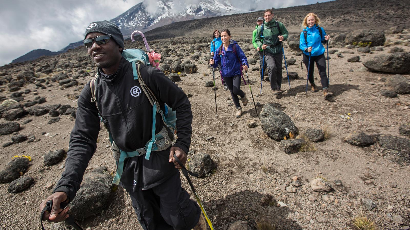
The Lemosho Route : Mount Kilimanjaro is the highest free-standing mountain in the world at a height of 5.985 meters, 19341 ft. mt Kilimanjaro has the most accessible summits unlike other mountains as that are almost as high. The majestically located snowcapped peaks stands alone overlooking the savannah plain that extends beyond it.
What is particularly special about mt Kilimanjaro?
Mount Kilimanjaro has three volcanoes, The Mawezi at 5.280m in the East, Shira at 4.269m in the west youngest of them all Kibo at 5.895m. Kibo is the youngest but has the most recent history of volcanic activity even though it lies dormant currently. The last eruption was between 150,000 to 200000 years ago.
How long is the Lemosho Route?
Ever wondered how many miles is the Lemosho Route? Lemosho route is a 70km long, approximately equal to 42 miles long, through the Lemosho route you will reach the Kilimanjaro summit at the Uhuru peak approximately 5895m above the sea level.
Ground rules are, you don’t have to have the experience from climbing the alps mountains! However, having any mountain or hike experience would be plus and would increase the chance to summit successfully. Also, you don’t need high-end technology equipment to enjoy your climb although you may need to use both your hands and feet at some few places.
Everyone with the guts to dare, book and prepare has an equal chance to summit as long as you tell yourself the truth about the harsh mountain conditions and give yourself enough pace for the ascent and acclimatization. Extremes of weather can hit really hard alongside the altitude sickness even for the experienced climbers so its good not to be rebellious to your own body response.
A waterproof cold weather coat and sleeping bags as well as water bottle are essentials to your success climbing and mid climbing camping.
The pattern of the weather is difficult to predict, the forecast is all over the place, too unpredictable to ascertain. However basically, June through October is the best season for hiking, the temperature averages to 22 degrees centigrade and summiting temperature can go as low as 7 degrees centigrade.
Lemosho route success rate
Lemosho is one of the routes with a good success rate when you do take your time. Here are a few evidences:
There is 90% chance that you will reach the summit if you take 8 days through the Lemosho, and for 7 days hike you will need to risk 5% success rate with the one day less that you omit. For 6 days you will only have 65% chance of completing the hike to the summit. However, in general the Lemosho route success for summiting are higher than the Machame counterpart.
General heads up remain, to take it slow and steady usually suggested to walk at a pace enough to be able to have a conversation with your peers. Always have snack for energy boosting, the mountain gets cold with the altitude and your body uses energy to maintain you at the temperature independent from your surrounding and a hike is a lot of work by itself that requires an obvious energy boost. Alongside energy boosting, hydration is very vital for body fluid maintenance but also its found to reduce altitude sickness.
An overall prior preparation like a marathon or a smaller hike plays a great role in mental strength to keep going but also gets your cardiovascular system boosted and in shape for low oxygen tension levels as well as your musculoskeletal for the physical strain
Lemosho route in summary for 7-8 days hike.
One could use as little as 6 days hiking the Mt Kilimanjaro but 8 days are ideal for a better and gradual adaptation to the high altitude.
The beginning of the trek is through the rainforest and then to the Shira ridge leading to a relatively flat hike directing to the east from west. You are likely to have a lonely trek, you only may meet a few crowds in between until the rout joins Machame route near the lava tower.
This route goes through the Kilimanjaro icedfields on the southern circuit path before summiting via Barafu. After summiting the descent will be through the Mweka route. Previous trekking experience is highly recommended, as the days will feature 6-8 hours hiking with daily ascents of 900m to 1,000m, perhaps with the odd day ascending around 1,100m to 1,200m.
Depending on the route, you may be trekking at an altitude of over 3,500m. You need complete confidence in your ability to trek for many days over difficult terrain. Extremes of altitude and weather may be encounter. A degree of physical and mental stamina will be essential to complete the hike as the days will be tiring.
These itineraries are comparable in length to the ones of the Machame Route.
